|
Home | Overview | Lesson One | Lesson Two | Lesson 3 | Lesson 4 | Lesson 5
Animal Database | Assessments | Desert Causes Database | Desert People
Plant Adaptation Database | Terrain Database | Vocabulary Database
AIMS:
1. Where are the world's deserts
located?
2. What are the types of desert terrain?
MOTIVATION: Have students look at a biome map of the world
with the desert biome highlighted. A good map to use is taken from http://enchantedlearning.com/biomes/desert/desert.shtml
PROCEDURE:
1. Have students review from the previous lesson what are some
causes of desertification? (They can review this information at http://mbgnet.mobot.org/sets/desert/index.htm
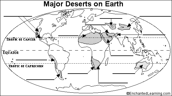
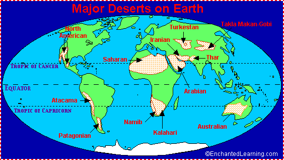
2. Have students label a blank world
map with the locations of the world's deserts. The following map was taken
from http://enchantedlearning.com/biomes/label/desert/
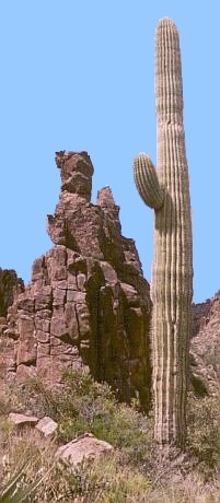
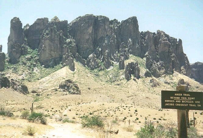
3. Explain to the students that not
all deserts share the same physical terrain. Show the class the following
examples of desert terrain taken from the following websites: http://mbgnet.mobot.org/sets/desert/index.htm,
http://library.thinkquest.org/28855/landscape.html and http://richmond.edu/~ed344/webunits/biomes/desert.html
4. Have the students fill in a
database on the five different types of deserts. They will link to the
following website http://library.thinkquest.org/28855/landscape.html A student copy is
found by clicking here.
TYPE OF TERRAIN |
DESCRIPTION |
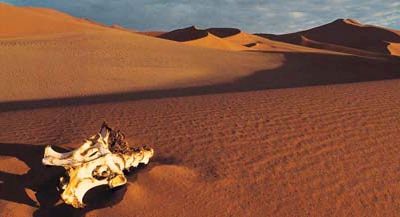
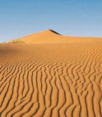
SAND DESERTS |
SAND DESERTS are not only
defined for their vast areas of sand, but also for the numerous linear dune
systems they have.
|
STONY DESERTS |
STONY DESERTS are also called 'serir'
in Egypt, they have comparatively level gravel surfaces.
|
ROCKY DESERTS |
But ROCKY DESERTS are
different, they usually have bare rock surfaces, and huge pavements clear of
sand and gravel.
|
PLATEAU DESERTS |
PLATEAU DESERTS which are also
named 'mountain-and-bolson deserts' or 'badlands', are dominated by rocky
plateaus, often cut apart by river channels which contain rain water.
|
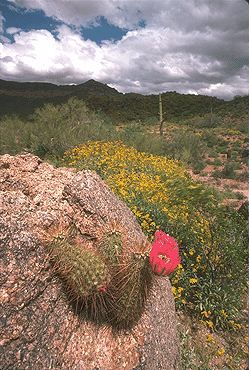
MOUNTAIN DESERTS |
As for MOUNTAIN DESERTS, they
are bare and arid orders or jaggedy rock peaks. These mountains include the
Tibesti and Ahaggar ranges of Sahara, the ranges of Sanai, and also the
Macdonnell mountains in central Australia. |
ACTIVITY:
The following activity is written in Scientific Method and taken from Earth
Science for Every Kid, by Janice Van Cleave, John Wiley and Sons, Inc. N.Y.
1991
Problem: How can we demonstrate the formation of sand dunes?
Hypothesis: We think if sand dunes are created by the force of wind, then
we can create a sand dune by using our breath to push flour.
Materials: Drinking straw, flour, and shallow baking pan.
Procedure:
1. Cover the bottom of the baking pan with a thin, flat layer of flour.
2. Use the straw to direct your exhaled breath toward the edge of the
flour.
Observations: The flour moves away from the end of the straw in a
semicircular pattern. The flour piles up close to the end of the straw.
Conclusion: The moving air leaving the straw has kinetic energy (energy of
motion). The flour particles are small enough to be lifted by the moving
air and carried forward. Some of the smaller particles move farther away,
but most lose energy and fall, forming a mound near the end of the straw.
As this mound builds, it blocks the movement of even the smaller flour particles
that would have traveled farther. This demonstrates the formation of sand
dunes.
ASSESSMENT:
After doing the Lab Activity, have students write the results of their
experiment in their own words. Give the students a digital camera and have
them take pictures of the same sand dunes on a spot on the beach for a few
successive days of each week. They can then document with the pictures how
the sand dunes have moved.
FOLLOW-UP: This lesson will lead to the next lesson: What are some
desert plants?
|