I am in my sixth year of teaching. I have taught both second grade, and third grade students. I have served as a reading intervention teacher, and as a writing instruction cluster teacher.
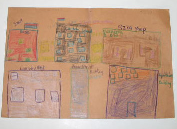
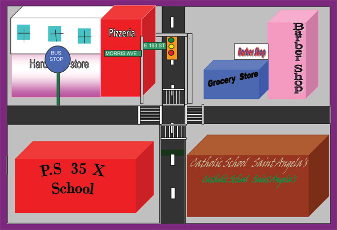
In order to build background knowledge, and integrate vocabulary, students created and narrated "My Urban Community" books. Maps were created using Microsoft Office drawing tools, instead of the SimTown software. The map-making activity focused on places in the community which were located around the immediate school vicinity.
Instructional
Objectives
Students were able to:
Understand what made their community an urban community.
Create and narrate books featuring the dwellings and locations where people in their community live, eat, and shop.
Utilize prior knowledge to create hand-drawn maps of their school vicinity.
Use digital photography to assist them in the creation of computer-generated maps.
Technology Integration
Used digital and 35mm disposable cameras to photograph their community.
Narrated their community books on a video camcorder.
Used Microsoft drawing tools to create computer-generated maps.
Assessment
The students were required to use graphic organizers, texts, and maps to identify, communicate, and illustrate elements and features of their community.
Tips
for Teachers
Have students use logs to record and describe the locations in their photographs. In addition to the photographs, the log helps them to better recall the features and details of their community.
Student Work Samples
Click on each thumbnail to see a full-screen version.


