Objectives:
Identify significant geographic features and landmarks of Ancient Egypt.
Create a map of Ancient Egypt.
Key
Words:
Nile River
Mediterranean
Sea
Red
Sea
Cairo
Pyramids
of Giza
Pyramid
of Khafre
City
of the Dead
Upper
Kingdom
Lower
Kingdom
Valley
of the Kings
Valley
of the Queens
Great
Sphinx
Memphis
Thebes
Timeline:
3-4
hours
Materials:
map template
brown butcher paper or construction paper
color pencils
|
|
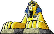
Great SphinxWhere
in Egypt is the Sphinx?
Procedures:
-
Tell your
students that in order to begin their journey to Ancient Egypt they
must first create a travel map of the region.
-
Have your
students find Egypt using a world map or globe.
-
Then ask them to
locate the Nile River.
-
Tell your
students that the Nile River was and still is the life-line of
Egyptian civilization.
-
Point out some
of the general geographic features of Egypt; (i.e. location,
landforms, etc).
-
Using the distance
calculator have students determine the distance between their
school address and the Egyptian capital of Cairo. Also, have students
determine the cardinal directions to Egypt.
-
Have your
students share their calculations and directions with the class.
-
Inform your
students that they are now ready to begin their journey to Ancient
Egypt.
-
Have your
students draw a freehand map of Egypt using the sample
template.
-
List the major
geographical features and landmarks of Ancient Egypt on the board.
-
Explain to your
students that they must use the sites listed below to locate these
landmarks.
-
Review with your
students the requirements for completing their Ancient Egyptian
Map.
-
Inform students
that their map will be graded based on completing all map
requirements. Completed map must have each of the following items:
-
Have students
add color to their maps.
-
Title.
-
Map symbols
for each geographic feature and landmark.
-
Map legend to
identify symbols.
-
Scale to
determine actual distance between landmarks.
-
Compass Rose.
-
Labeled
features and landmarks.
Assessment:
Maps
will be scored using the following rubric: Based on a (10)
point scale.
(1)
point - Title
(3)
points - Map Symbols/Legend/Compass Rose
(1)
points - Scale
(5)
points - Labeled features/landmarks.
10
points=A; 9-8 points=B; 7 points=C, 6 points= D;
less than 5=F
Extension
Activities:
Using
Print shop or Microsoft Publisher have students create a travel
brochure of Ancient Egypt based on their completed map.
Web Links:
Egyptian
Maps King
Tut National
Geographic Egypt
Tour The
Nile in Egypt Culture
Focus Egypt
|