| Carolyn Hornik
P.S. 101 |
Unit: Virtual Travel Brochure of Brazil |
Aims:
1. To appreciate the differences in climate from one place
to another.
2. To understand that geographical and topographical
factors result in changes of climate from place to place.
3. To develop an understanding of how the climate of
a region effects the economy and way of life.
4. To interpret graphs and charts.
5. To develop proficiency in using the Internet as a research tool.
6. To produce and share written and oral reports.
Standards Addressed:
1. Focuses on a geographic look at South America.
2. Understands how the climate of a country affects its economy and people's life styles.
2. Makes statements and draws simple conclusions based on data in line plots, graphs, tables, and charts.
3. Makes true statements based on a simple concept of average for a small sample size.
4. Participates in group meetings.
5. Prepares and delivers presentations.
Setting:
The activities in this lesson will be followed by the students in the "Climate Group." Roles will include researchers who will find information online using web sites chosen by the teacher, recorder who will record the important information found by the researchers (information may be recorded using a word processing application such as Learning Company's Student Writing Center or Microsoft Word), illustrators who will be responsible to find online photos (from web sites that will be prescreened by the teacher) or create illustrations of the topics researched by the group using a drawing and painting application such as Kidpix, reporters, who share the information with the class both in oral reports and in written reports, and web designers who will place the textual information and graphics onto a web site for the class's Virtual Travel Brochure.
Vocabulary:
| climate | elevation | humidity | precipitation | temperate |
| arid scrubland | interior | tropical | coastal | rain forest |
Materials:
computers with internet capabilities, printer, word processing application, drawing and painting application.
Motivation:
1. Using Grolier's Multimedia Encyclopedia,
students will locate the text article on Brazil and scroll down to the
section on climate.
They will then give an overview of Brazil's varying
climates. Students will describe the climate in
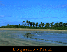
a. Brazil's interior
(arid scrubland)
b. northerly Amazon
jungle (tropical rainforests )
c. eastern coastal
beaches (tropical)
d. the south (more
temperate)
e. the north (rainy
seasons occur from January to April)
f. the northeast
(rainy from April to July)
g. the Rio/São
Paulo area (rainy from November to March)
2. Describe the clothing requirements
for Brazil's varied climates.
Development:
1. Students log onto WorldTravelGuide.Net
at http://worldtravelguide.net/data/bra/bra500.asp
and examine the climate graphs of Brazil's regions to
complete the chart below:
|
|
|
|
|
|
|
|
| elevation | ||||||
| hottest month | ||||||
| average rainfall | ||||||
| 3 months with most rainfall | ||||||
| most humid month | ||||||
| average number of sunlit hours | ||||||
| average humidity |
2. Students use the following web sites to continue researching
Brazil's climate:
http://agbrazil.com/climate.htm#climate
This site provides information about the seasons in the Cerrados region.
http://usatoday.com/weather/basemaps/foreign/samerica/wfbrazil.htm
At this site, students can choose a Brazilian city and a date and be shown a chart of weather related information. Satellite photos are included.
www.oxfam.org.uk/coolplanet/kidsweb/world/Brazil/brazgeog.htm
Cool Planet gives an overview of Brazil's climate.
http://brazilsite.com/dados/dingles/masternationalemblems.htm
This site contains a slide show which includes information about Brazil. Some information on Brazil's climate is included by region. Regions included are North, Northeast, Middle West, Southeast, and South.
http://unfccc.de/resource/ccsites/senegal/fact/fs120.htm
At this site climate variability in Brazil and its impact
on future
climate changes is discussed.
Summary:
From the information obtained in the research phase of this lesson, students will draw conclusions to answer the following questions.
1. Why is it important to study a country's climate?
2. How do you think a country's climate affects its economy
and the way people live?
Evaluation:
Students will be evaluated on their use of the Internet to find information about Brazil's climate and synthesize that information to produce oral and written reports. Students should also be able to conclude that there is a relationship between the climate of a region, its economy, and the lifestyle of the people who live there. Students will also be evaluated on their choice and use of visual aids, and their ability to communicate the information in their reports to the class in their presentation.
Follow Up:
Students create a three dimensional map of Brazil (papier
mache or modeling clay may be used) showing climates of various regions.
A key (including temperature, humidity and precipitation) will be used
to describe the climate of each region.
 Click here to return to the Table of Contents.